

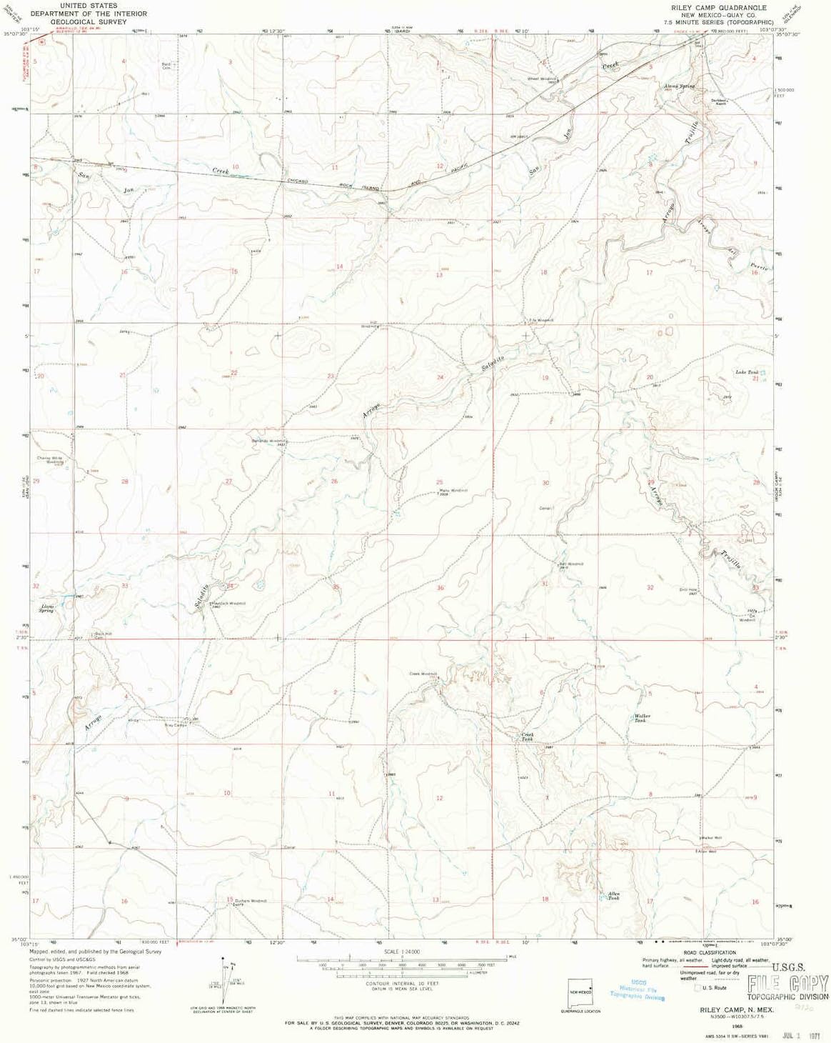
Beartooth Publishing Hunting Unit 8 (Western State Hunt Area Maps, AZ-8) Topographic Map, Matte Finish, Pink
Product details
| Management number | 215179816 | Release Date | 2026/04/12 | List Price | $36.00 | Model Number | 215179816 | ||
|---|---|---|---|---|---|---|---|---|---|
| Category | |||||||||
This topographic surface management map covers Arizona Game Managment Unit 8. It has been assembled using USGS and BLM mapping data with a red game management unit boundary overprint. It features varying topographic contour intervals as well as lat/long and UTM grid coordinates.Waterproof paper, one-sided folding map. Size: 36" x 24"This map contains the following named places: 86018, 86324, 86334, 86336, Abra, Anderson Butte, Antelope Wash, Arizona Highway Maintenance Yard, Ash Fork, Ash Fork Substation, Aspen Hill, Bald Hill, Bar Heart Ranch, Barney Knoll, Barrata, Bear, Bear Mountain, Bear Siding, Benham National Recreation Trail, Benham Ranch, Benham Snow Play Area, Benham Trail, Big Black Mesa, Big Chino Wash, Bill Williams Mountain, Bill Williams National Recreation Trail, Bixler Mountain, Bixler Saddle Trail, Black Mountain, Bootlegger Crossing, Boyd Knoll, Boynton Tank, Buck Ridge Cabin, Buck Wildlife Guzzler, Bunker Hill, Buzzard Knoll, Camp Clover Ranger Station, Camp Cotton, Camp Navajo, Casner Mountain, Casner Mountain Trail Eight, Cedar Creek, Chalender, City Dam, City Reservoir, Colcord Hill, Coleman Knoll, Coleman Lake, Concrete Dam, Cotton Dam, Cruice Siding, Davenport Hill, Davenport Knoll, Deadman Knoll, Devils Pocket, Dogtown Campground, Dogtown Dam, Dogtown Picnic Ground, Dogtown Reservoir, Dogtown Reservoir Recreation Site, Dorsey Spring Trail, Drake, Dutch Kid Knoll, Eddy Place, Eightmile Creek, Finger Rock, Flat Mesa, Foley Dam, Frog Pool, Glidden Windmill, Golden Buckskin Mine, Granite Creek, Gray Ranch, Grindstone Wash, Hancock Ranch, Hat Ranch, Hells Pocket, Hidden Cabin, High School Hill, Hill One, Hill Three, Hill Two, Hog Hill, Horse Hill, Horse Hill Wildlife Guzzler, Horse Lake, Hyde Hill, Ice Pond, Indian Hill, Irishman Dam, Jackass Knoll, JD Cabin, JD Dam Lake, JD Dam Wash, Johnson Creek, KA Hill, Kelsey Winter Trail, Kennedy Dam, Kunde Knoll, Little Black Mesa, Little Lookout Trail, Lost Lake, Lost Mountain, Lower Saginaw Reservoir, Loy Butte, Loy Butte Five, Mack, Matterhorn, May Tank Pocket, McCracken Knoll Number One, McCracken Knoll Number Three, McCracken Knoll Number Two, McCracken Knolls, McDougal Flat, McLellan Dam, McLellan Reservoir, Meath, Meath Dam, Meath Siding, Meath Wash, Mexican Dam, Millers Pocket, Mills Quarry, Mineral Lake, Mooney Mountain, Mooney Trail, Morgan Hill, Morgan Ranch and Headquarters, Mud Tank Wash, Ott Lake, Overland Road Historic Trail, Pack Trail, Packard Mesa, Packard Ranch, Packard Trail, Page Wash, Paulden, Perkins Knoll, Perkinsville, Perrin Dam, Pinaveta, Pine Creek, Pine Flat Headquarters, Pine Hill, Pine Springs Ranch, Pine Tank, Pineveta Wash, Pocket Lake, Pollocks Substation, Prairie Siding, Quarter Circle X X Ranch, Railroad Dam, Rattlesnake Burn, Rattlesnake Mesa, Rattlesnake Wash, Raymond Pit, Red Butte, Red Canyon Ranch, Red Hill, Red Knoll, Reneke Knoll, Robbers Roost, Robin Tank, Rock Butte, Rok Siding, Round Mountain, Ruin Mountain, S P Hill, Santa Fe Reservoir, Sawtooth Peak, Scholz Lake, Secret Cabin, Secret Mountain, Seligman Junction Substation, Sereno, Sereno Siding, Sereno Spring, Seven Bar K Hill, Sherwood Forest Estates, Shiner Ranch, Signal Hill, Smith Butte, Snyder Knoll, Stage Station, Steel Crater, Steel Dam, Steel Dam Reservoir, Stone Dam, Sugarloaf Mountain, Sullivan Dam, Sullivan Lake, Summit Mountain, Sycamore, Sycamore Basin, Sycamore Basin Trail, Sycamore Canyon Wilderness, Sycamore Creek, Sycamore Rim Trail, Taylor Basin, Taylor Cabin, Taylor Cabin Trail, Thumb Flat, Tract 37, Tract 38, Tract 39, Tract Thirty Nine, Tule Basin, Tule Tank Wash, Turkey Butte, United States Mine, Upper Limestone Tank Dam, Upper Saginaw Reservoir, Verde Ranch, Volunteer Mountain, Volunteer Wash, Wagner Hill, Wagon Tire Dam, Wagon Tire Wash, Walnut Creek, White Horse Knoll, White Horse Lake, White Horse Lake Family Campground, White Horse Ranger Station, White Horse Recreation Site, Wild Steer Mesa, Williams District Ranger Station, Williams Junction, Williams Ski Area, Williams Ski Run, Williamson Valley Wash, Williscraft Dam, Wineglass Ranch, Winter Cabin Trail, Wood Spur Siding, and Wounded Ranger Knoll. Read more
Bestseller ranking
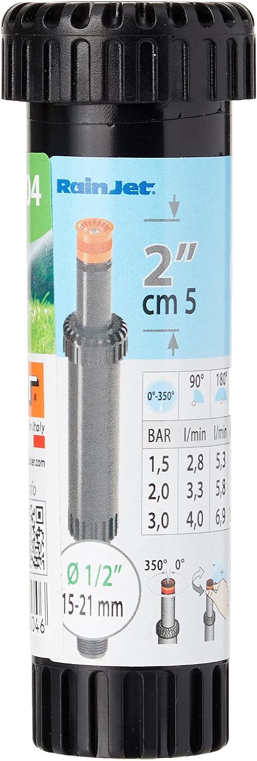
Hose Connectors & Accessories


![Topper Turbospruzzo Sprinkler 8660 Claber [Claber]](https://m.media-amazon.com/images/I/61dp0te4NDL._AC_SL1500_.jpg)

Customers who viewed this product also viewed
Topographic Maps


Correction of product information
If you notice any omissions or errors in the product information on this page, please use the correction request form below.
Correction Request Form